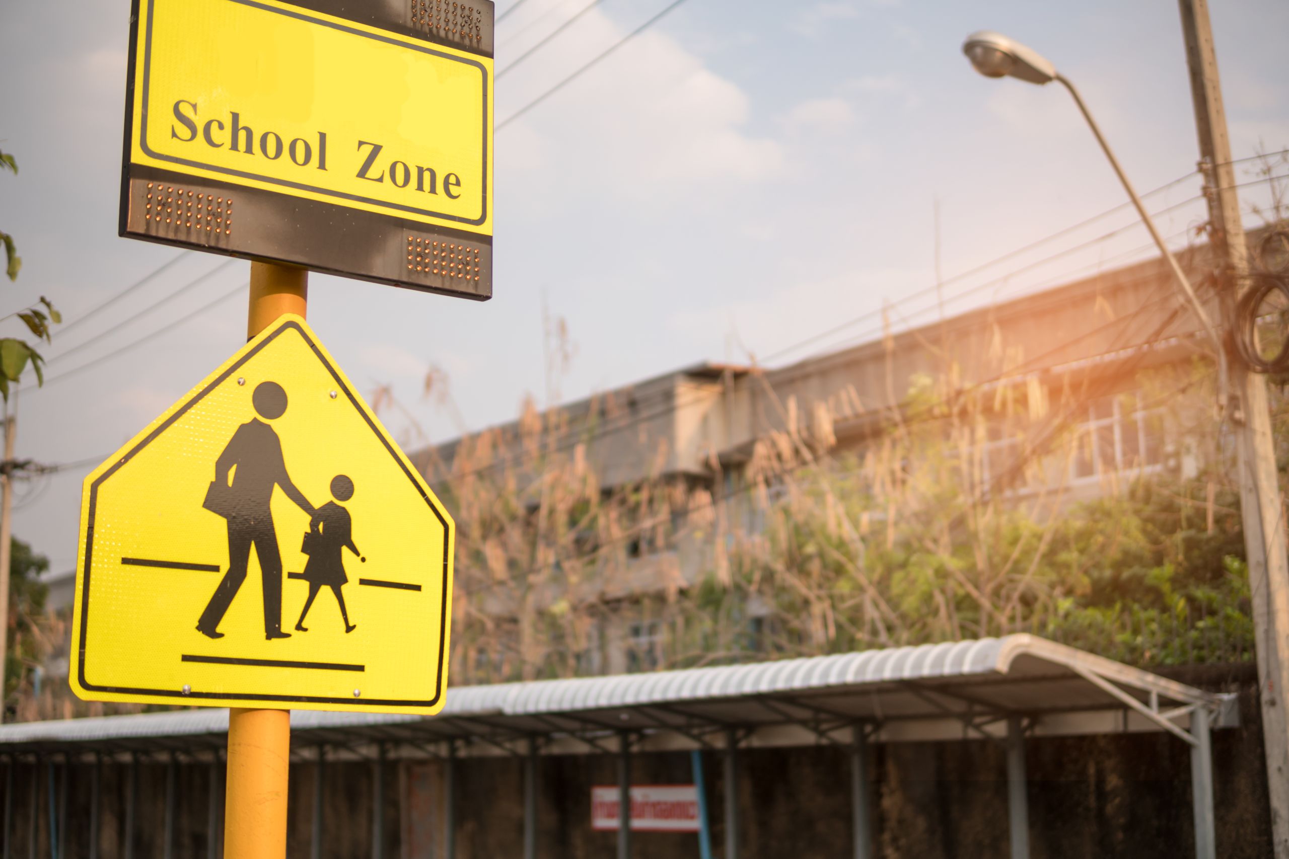
School Walk
Family-friendly neighbourhood planning

When you think of your neighbourhood, chances are the community spaces that come to mind include your street, the local park, and the neighbourhood school. This isn’t surprising: an elementary school is typically a centerpiece of a neighbourhood and it becomes a focal point for travel twice a day for children and parents. Whether by walking, driving, or taking the bus, the trek to school is a fixture of neighbourhood life and, as such, can influence how a community is understood and planned.
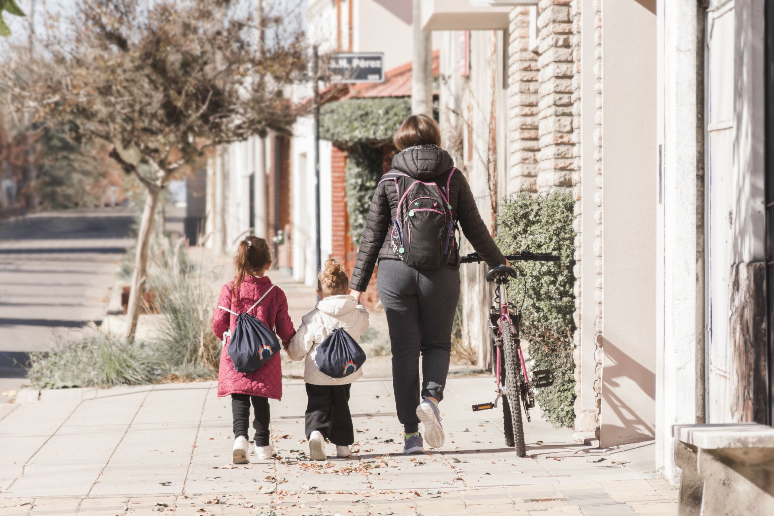
This movement between home and school links community planning with public health, in the context of active transportation and physical activity. Active transportation refers to any form of human-powered transportation—walking, cycling, using a wheelchair, in-line skating or skateboarding—and there are many ways to do it, whether it is walking to the bus stop, or cycling to school.
Because most elementary schools in Canada and Ontario draw their students from the immediate surrounding area, schools can play a central role in encouraging active transportation, and in advocating for community design that facilitates it. Recent research from the University of Toronto suggested that encouraging children to be active at a young age through daily routines, like walking or wheeling to school, has a long term positive impact of levels of inactivity later in life.
The importance of schools as community hubs to encourage active transportation is recognized by school boards, municipal governments and transportation agencies alike. In Ontario, Metrolinx, the regional transportation agency for the Greater Golden Horseshoe, oversees school travel planning, encouraging local school boards and municipalities to work together to create active travel plans for their communities. To better understand the challenges limiting families from walking and wheeling to school, some preliminary assessment practices have been used: asking kids to do a classroom “hands up” count as to how they get to school, or family travel surveys—which inform travel plans. While these give an important first glimpse into each school community, more effective engagement tools could help promote active transportation via schools.
But while it’s important to find out if people are walking or wheeling to school, to improve the experience it’s even more useful to figure out what routes they are taking.
At Civicplan, we wanted to get at this central point through the design and development of an engagement tool that records how and where people walk/wheel to school. Partnering with Public Health Services at the City of Hamilton and with funding from the Ontario Government’s Healthy Kids Community Challenge, the team designed and implemented a pilot project targeting a typical suburban neighbourhood in Hamilton.


The Engagement
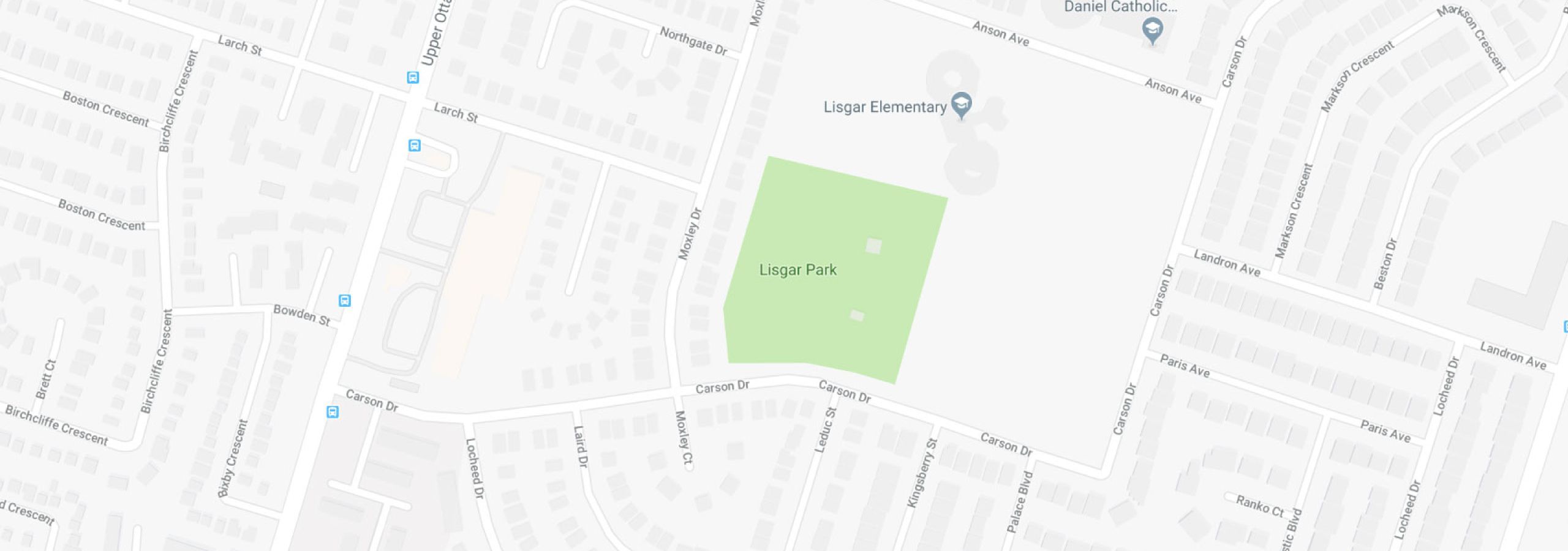
Lisgar neighbourhood is located on the east mountain in the city of Hamilton. At the centre of the neighbourhood are two elementary schools, one public and the other catholic. The neighbourhood is bounded by major arterial streets that carry significant daily traffic, while in the middle of the neighbourhood, adjacent to the schools, is Lisgar Park.
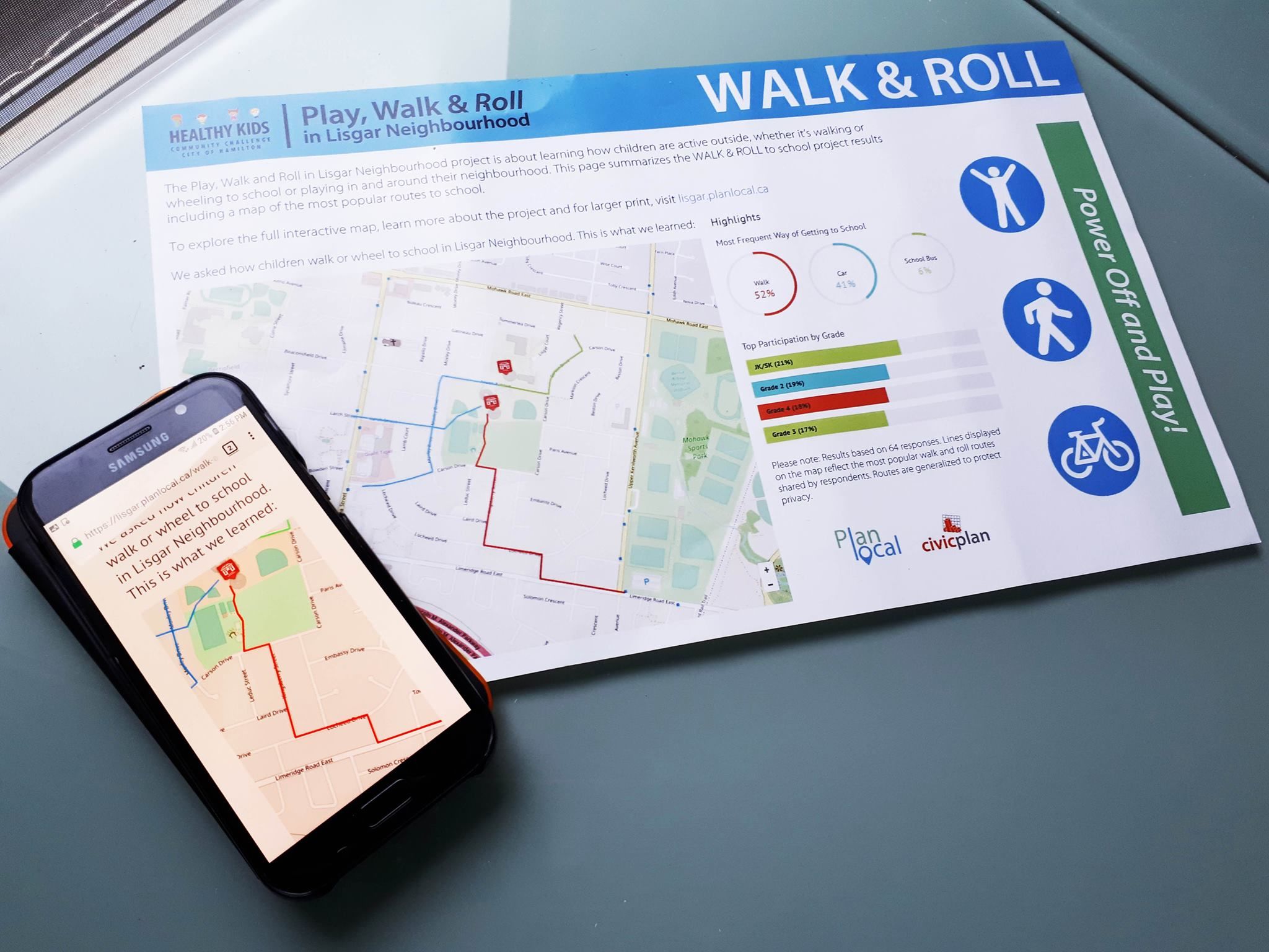
In the Spring of 2018, families at both schools were asked to complete a survey about how they travel to and from school each day, the route they take, and obstacles they face. Both a take-home survey, and an online option were provided to parents who were encouraged to complete the questions with their children, including drawing their routes on a digital map. A project engagement website provided background information and updates as the project proceeded. Additional questions about physical activity in the neighbourhood were included to learn more about how and where kids play outside in Lisgar neighbourhood, as well as in adjacent areas.


The Walk to School Results
The results of the pilot project revealed a number of interesting findings. First, the majority of respondents (52%) indicated that their children walked/wheeled to school most often. Not surprisingly, the second most popular choice was being driven (41%), followed by taking the school bus (6%). When children walked to school they were accompanied most often by an adult from their immediate family. (Participants’ grade levels ranged from Junior Kindergarten to Grade 4, with Kindergarten being the most prevalent.)
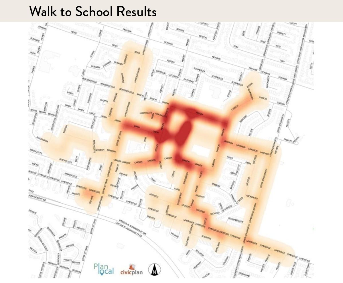
Heat mapping provided a snapshot of where the most popular routes overlapped and where there were particular pinch points.
Follow-up observational street audits of the most popular routes determined if there were obstacles preventing the safe and easy travel to school. The key obstacles to safety tended to be dangerous intersections across major arterials, and unsafe zones near the neighbourhood park as well as in front of the schools themselves.
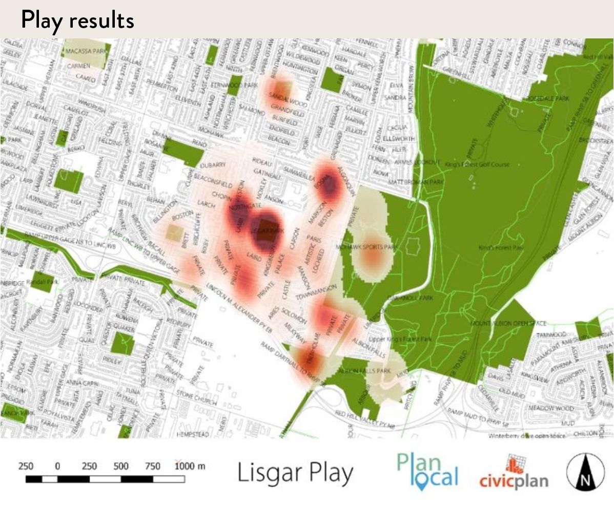
Play Results
An additional level of engagement included feedback about outdoor play activities. Children were asked where and how they play in the neighbourhood outside of school hours. In total, over 420 activities were recorded and mapped as part of the project in over 50 neighbourhood locations.
The results about play also offered important insights. First, the neighbourhood park was identified as a hotspot of activity and the major focal point for neighbourhood recreation.
While that might not be surprising, what was interesting was that, overall, the streets and sidewalks closer to home were also a common location for play, demonstrating that they, too, are important public neighbourhood spaces alongside more typical recreational spaces.
A key element of the pilot project was to report back to the community. As a first step, the results were posted on the project website (https://lisgar.planlocal.ca). Secondly, a printed visual summary of the results was included in take-home packages for each student in the fall of 2018. Interactive mapping showing play activities and locations, and the most popular routes to school were provided to residents in order to help continue the dialogue about more active lifestyles in their neighbourhood.

Lessons Learned
There were three major takeaways from this project.
First, understanding how a neighbourhood walks/wheels to school and plays outside are important first steps to community conversations about more active lifestyles. The pilot project records what people are currently doing, and shares these experiences and behaviour with the broader community as easy, local options for others to incorporate into their lives.
Second, neighbourhood schools provide a valuable focal point for engaging the community. In communities with few organizational structures, such as neighbourhood associations, engagement can be difficult. Elementary schools, by design and function, are community anchors and provide social connections to the surrounding neighbourhood.
Third, engagement on walking/wheeling to school can be used to enhance community planning. For example, street safety is an issue in most neighbourhoods. When streets are observed through the lens of the daily journey to school, obstacles and hazards for multiple ages are more readily drawn out. The results from the Lisgar project identified 13 unsafe neighbourhood locations that can be remedied through basic street calming measures. This is valuable information for transportation planners.
Future Opportunities
Overall, the project provides an example of how school-centred engagement could be the basis for a more enhanced and responsive form of community planning. Further, by focusing on the local school, school boards could be encouraged to engage more in the planning of the neighbourhoods in which they are located. This would lead to more holistic, safe and responsive neighbourhood planning over the long term to the benefit of all community members.


Paul Shaker and Sonja Macdonald are Principals with Civicplan, an award-winning community planning and public engagement group that helps people shape communities. For more information on this study visit https://civicplan.ca.